Map Regions
Advertisement
HTML5 GeoChart Package v.1.5
Built using HTML 5, VectorWorkz GeoChart are readily compatible with all devices and web-development platforms. Build heat maps to visualize business performance by state or country, political data like election results, weather severity, etc. Or you c
Advertisement
WPF GeoChart Package v.1.5
Built natively for WPF, VectorWorkz WPF GeoChart allows you to build heat maps to visualize business performance by state or country, political data like election results, weather severity, etc. Or you can also visualize performance of specific office loc

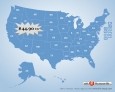
GPS Navigator aSpass v.1.5.0.0
Update v1.5 - Search for Points of Interest (POI) aSpass Gps Navigator provides voice guided, turn by turn navigation for your WP7. A fast and accurate route calculation combined with voice instructions and clear onscreen directions. And with Map

Click-and-Drag Map of UK regions
Click-and-Drag Map of United Kingdom for websites with wysiwyg editor tool. Add pinpoints on a map. Features: Driven by XML interface; - Color, URL linking, captions and more. And you can do all these; - Intuitive Flash Map Interface; - Ease of Use; -

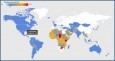
World Map in Flash
XML-driven World Map in Flash is a powerful, full-featured, and flexible mapping solution to present any kind of business or personal data worldwide. It took web-mapping experience, intelligence and time to deliver a solution we are proud of. The main
IMapBuilder Interactive Flash Map Builder v.6.86
iMapbuilder is an interactive map program for Webmasters and anyone else who want to build professional, clickable, interactive maps for their web site, but is just too busy to learn Flash, programming or additional mapping software. Download
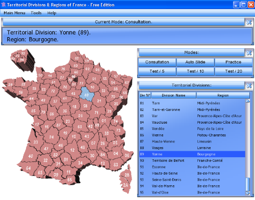
Territorial Divisions & Regions of France v.1.0
Territorial Divisions & Regions of France is an educational software, based on a 3d clickable map of France Metropolitan, that includes Consultation and Test modes.
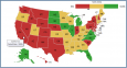
Flash Map US States Silver (with FLA source)
US States Flash map Silver (with FLA source) for web sites, interactive applications, presentations, and more. Flash maps suitable for Real-Estate, Dealer Maps, Branch Offices Locators. Set states/counties clickable with hyperlinks (URL). Define colour
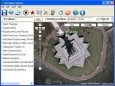
Arm Map Explorer v.2.2
Arm Map Explorer recreates all the functionalities of Google Maps while adding new ones like viewing a map with a coordinate grid on it, getting precise coordinates of any location on a map, moving to a needed location based on specified coordinates.
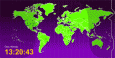
Time Zones Map in Flash
Flash Time Zone Map is " A ready-to-use and customer-friendly flash world time map with no HTML or Flash knowledge required Flash Time Zone Map has " 20+ high quality images for the timezones map background " Included source code
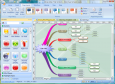
Edraw Mind Map v.7.8
Edraw Mind Map is a vector-based mind mapping software with rich examples and templates which make it easy to create mind maps, brain-storming diagrams, project timeline, life planner, SWOT analysis and sketch maps.